Georadar Explorer 3.0
Georadar Explorer 3.0 - Ground Penetrating Radar for underground utilities detection and mapping
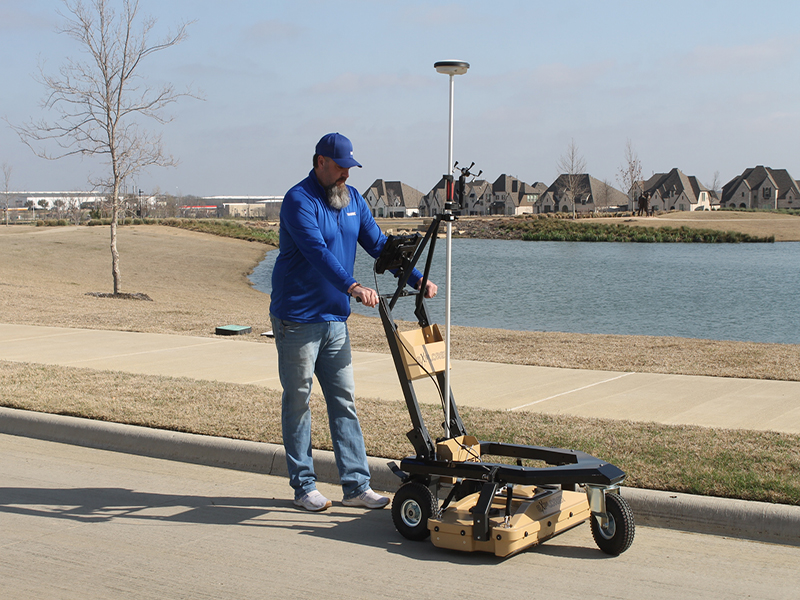
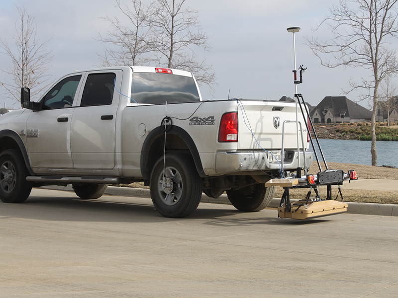
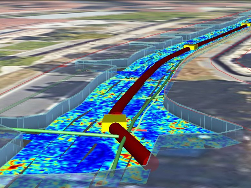
Tesmec Georadar Explorer 3.0 is a Ground Probing Radar - GPR - which detects underground utilities, optimizing trenching and laying operations. This system has been developed to guarantee the safety of trenching work sites and to increase operational speed, avoiding utilities strike incidents. Utilizing Explorer 3.0 reduces risks and costs by providing non destructive surveing to locate underground networks.
The 3.0 new systems has been reduced in size, making it easier and more practical. The new brakets lock and stabilize the antenna during acquisition, facilitating its movement. All the electronics, including the Control Unit, are inside the antenna box. Lithium batteries, reduced in size and weight, replace the previous lead - acid batteries and guarantee a longer service life. The GPR, integrated with Gaia (the mobile Lidar 360° detection system through photographs and 3D laser scanner) and the drone (for a high definition aerophotogrammetry) provide a mobile laboratory for a state-of-the-art jobsite.
Benefits
- High location accuracy
- Clearest outputs, 30 acquisition channels
- GPS integration
- Google maps integration
- High acquisition rate (> 4000-5000 sqm/day in trolley configuration)
- High acquisition rate (> 15000-20000 sqm/day in trolley configuration)
- Reduced post-processing work
- Reduced working time
- Transversal scans are no longer necessary
- Real time buried utilities visualization
- 3D dwg drawings in real coordinates
- User-friendly interface
- Easy As-built documentation Record references for the future
- EPT (Easy Pipe Tracking) Android App
- Multiple applications, from carriageway to footways
- Fundamental in investigations on footpaths
- All-material detection, from metals to plastics
Technical Features

- All-terrain wheels with brake (on rear wheel on the right)
- Multi-antenna Array with dual polarization, antenna box protection with height adjustment system
- One piece antenna box
- GPS attachment (gps kit as optional)
- Ergonomic and fast connectors (4 height positions selectable)
- Wheel-free side for investigations next to sidewalks and obstacles
Technical Specifications
| METRIC | METRIC US | |
| Sensor frequency | 600 MHz | 600 MHz |
| Weight | 42 KG | 92 pounds |
| Scan width | 82.5 cm | 32” |
| Number of channel | 30 (19VV - 11HH) | 30 (19VV - 11HH) |
| VV channels spacing | 4.3 cm | 1.7” |
| HH channels spacing | 7.5 cm | 2.9” |
| Power consumption | 120 L | 31.7 gal |
| Acquisition | 19 W | 19 W |
| Stand-by | 15 W | 15 W |
| Max operating time | 8H (can be extended) | 8 hrs (can be extended) |
| Environmental | IP65 | Waterproof |
| Max. acquisition speed | 14 km/h | 8.7 mph |
| Temperature range | -20 C° / 50 C° | - 4° F/ 122° F |
| Scan step resolution | 4 cm | 1.5 “ |
| Positioning | Integrated Encorder and PPS External GPS and TPS |
|
| Certification | EC, FCC, IC | |
| Recommended laptop | PANASONIC FZ62 |